
Best Hikes in El Hierro (2026): Camino de Jinama, El Sabinar, La Llanía & Camino de la Virgen
El Hierro's best hikes: the reopened Camino de Jinama, the juniper forest of El Sabinar, the easy La Llanía loops and the full-day Camino de la Virgen. Distances, start points and what to check first.
Some links in this guide are affiliate links: if you book through them we may earn a commission at no extra cost to you. It never changes what we recommend. Full disclosure.
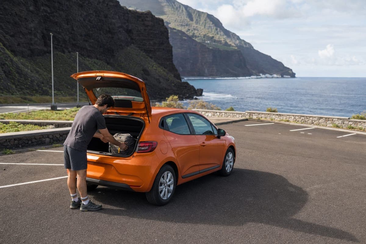
With few buses and trailheads far apart, a hire car is the practical option for most hikers on El Hierro. Compare El Hierro car hire ↗
Hiking on El Hierro: no permits, plenty of driving
The smallest of the main islands is one of the best for walking, and none of its main trails needs a permit or booking. The challenge is logistics: the island is steep, the roads are slow, buses are infrequent and many of the best routes are one-way between villages hundreds of metres apart. Hire a car, plan linear routes around a taxi or a second car, and carry water: the west and south have almost no shade.
Camino de Jinama: the old road to El Golfo
Before the road was built in the 1960s, this cobbled mule path was the main way between the El Golfo valley and the upland villages. It climbs about 8 km from the church of La Candelaria near Frontera up the cliff to the Ermita de La Caridad and San Andrés, with around 800–885 m of ascent depending on the source, roughly three hours uphill. It is graded high difficulty. The path was closed by a large rockfall in December 2022 and reopened by the Cabildo after repair works, but it is still a cliff route: check its status before you go, especially after rain. Walking it downhill from San Andrés is easier on the lungs and harder on the knees.
El Sabinar and La Dehesa
El Sabinar, the wind-bent juniper trees of the island's west, is El Hierro's most photographed place. The circular route PR-EH9, a little over 7 km with variants, starts at the chapel of Nuestra Señora de los Reyes in La Dehesa and passes the Sabinosa viewpoint over El Golfo. The last stretch of road is an unpaved track that you should drive very slowly, and the area has no shade and no water, so carry both and avoid the middle of a summer day.
La Llanía: the easy forest loops
Off the HI-1 road that runs from Valverde to the south-west, the La Llanía routes are the island's best easy walking: three circular variants of about 4 to 7.5 km through laurel and heather forest, past the Hoya de Fireba crater and the Bailadero de las Brujas, to the La Llanía viewpoint over El Golfo. Cloud often sits on this ridge, which is what keeps the forest green, so take a layer.
Camino de la Virgen: across the island in a day
The Camino de la Virgen, part of the GR 131, crosses the island for just over 27 km from the chapel of Nuestra Señora de los Reyes in La Dehesa to the church of La Concepción in Valverde, along the shepherds' trail used every four years by the island's great procession, the Bajada de la Virgen. It passes Malpaso, the highest point of El Hierro, and needs a full day, preparation and transport arranged at both ends. Many walkers split it into sections.
Frequently asked questions
Is the Camino de Jinama open?
Yes. It was closed by a rockfall in December 2022 and reopened by the Cabildo de El Hierro after repair works. As a cliff path, it can close again after rain or rockfall, so check its status before you go.
Do you need a permit to hike on El Hierro?
No. The island's main trails, including Jinama, El Sabinar, La Llanía and the Camino de la Virgen, need no permit or booking.
How long is the El Sabinar walk?
The circular route PR-EH9 is a little over 7 km, with variants, starting at the La Dehesa chapel. Allow extra time for the slow dirt track to get there.
What is the easiest hike on El Hierro?
The La Llanía loops off the HI-1: three circular variants of about 4 to 7.5 km through the forest, with a viewpoint over El Golfo.
Compare recommended experiences
We select these options for relevance and traveller fit. Some booking links are affiliate links, so we may earn a commission at no extra cost to you. How our recommendations work.
El Hierro
Compare Car Rental at El Hierro Airport (VDE)
Compare current VDE car rental offers by total price, supplier score, deposit and terminal or meet-and-greet pickup.
- VDE-specific offers
- Supplier ratings
El Hierro
El Hierro Airport Private Transfer
Compare a private or shared transfer from El Hierro Airport (VDE) to Valverde, La Restinga or your accommodation.
- Airport pickup
- Private or shared
El Hierro
El Hierro Beginner Scuba Diving in La Restinga
Try scuba diving for the first time in La Restinga with theory, full equipment and a professional instructor beside you throughout the sea dive.
- Professional instructor
- Full diving equipment
Plan the rest of your El Hierro trip
Useful booking links for the services currently available for this island. Attraction tickets are only shown when a specific, verified destination is available.
Find your hotel
Hotels and apartments in El Hierro
Search stays →Rent a car
Compare rental cars in El Hierro
Compare cars →Airport transfer
Private door-to-door taxi
Book a transfer →Travel insurance
Medical & trip cover for your Canaries trip
Get covered →Some links are affiliate links — we may earn a commission at no extra cost to you.
Planning the rest of the trip? See everything on our El Hierro island page.
Continue planning
- El Hierro Travel Guide: Diving, Hiking & Total EscapeThe smallest Canary Island for divers, hikers and anyone who wants the Atlantic to themselves — with the honest practicalities of getting there.3 min read
- El Hierro Itinerary: 3, 5 or 7 DaysCombine El Golfo, La Restinga, El Sabinar, viewpoints, forests and natural pools in a realistic El Hierro itinerary.2 min read
- Getting Around El Hierro (2026)Plan El Hierro by rental car, bus, taxi or transfer from VDE airport and La Estaca ferry port.2 min read